Calgary International Airport (YYC)
Driving Directions / Travel by Car
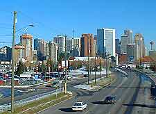
(Calgary, Alberta - AB, Canada)
An important part of the Calgary area, Calgary International Airport (YYC) is a major airport in Alberta and lies close to the city center. The airport complex is surrounded by a number of main roads, which include the Barlow Trail NE (Highway 2A) to the east, and the Deerfoot Trail NE (Highway 2) to the west.
Of particularly interest, Calgary International Airport is located directly east of the Nosehill Natural Environmental Park, also being situated close to Fish Creek Provincial Park and the Foothills Industrial Area.
Directions to Calgary International Airport (YYC) from the city center:
- The airport is situated close to central Calgary, to the northeast of the city
- Central Calgary can be reached by car in approximately 20 minutes, depending upon traffic
- Follow the sign posts and then turn into the airport grounds
Directions to Calgary International Airport (YYC) from Banff:
- Drive along the Tunnel Mountain Drive
- Follow the T-C Highway 1, also known as the Alberta Route 40
- Turn onto the Barlow Trail Northeast and follow signposts to the airport, continuing along Airport Road Northeast
Directions to Calgary International Airport (YYC) from Drumheller:
- Drive along 4th Street East
- Take a right turn onto 5th Street and then travel along Alberta Route 9
- Turn right and follow the Township Road 262
- Turn left onto the Barlow Trail Northeast, and then follow signposts to the airport, continuing along Airport Road Northeast
Directions to Calgary International Airport (YYC) from Edmonton:
- Drive along 109th Avenue Northwest
- Take a right turn onto 108th Street Northwest
- Take a further right turn onto 10th Avenue Northwest
- Turn left and travel along 109th Street Northwest, which in turn leads to Walterdale Hill Road Northwest
- Turn left and travel along Whyte Avenue Northwest
- Turn right and head down 104th Street Northwest, which in turn leads to the Calgary Trail North and ultimately Alberta Route 2
- Continues along Country Hills Boulevard, turning right onto the Barlow Trail Northeast
- From here, Calgary International Airport will be clearly signposted
Calgary International Airport (YYC): Virtual Google Maps
